This private website about the former steam brick and fireclay goods factory Jawurek & Co. in formerly Zablacz-Oderberg (now: Bohumín Záblatí, Karviná District in the Czech Republic) serves to bring together all available information in one place and index them via various internet search engines.
Oderberg (Bohumín)
Bohumín (German: Oderberg) is a town in Karviná District, Moravian-Silesian Region, Czech Republic on the border with Poland. The confluence of the Oder (Odra) and Olza rivers is situated just north of the town. The town lies in the historical region of Cieszyn Silesia. Before World War II, the town was inhabited by a large German community.
The town was first mentioned in a border agreement between Władysław Opolski, the duke of Opole and Racibórz and Ottokar II of Bohemia, in 1256 as Bogun (today's Old Bohumín).Historical documents regarding the first centuries of the town are scarce. King Louis II granted the town and château of Bohumín to George, Margrave of Brandenburg-Ansbach in 1523.
At the end of the 19th century a wire and rolling mill was built by German industrialists from Berlin, Albert Hahn and Heinrich Eisner. In 1872 the important Kassa-Oderberg railway line was opened to traffic; this increased the town's importance and contributed to the Polish - Czechoslovak dispute over Cieszyn Silesia after World War I. After the division of Cieszyn Silesia in 1920, the town became part of Czechoslovakia. Following the Munich Agreement, Bohumín and the Zaolzie region were annexed by Poland in October 1938. The town was then annexed by Nazi Germany at the beginning of World War II. On 1 May 1945 Bohumín was taken by Soviet troops of the 1st Guards Army. After the war it was restored to Czechoslovakia and the remaining German population was expelled westward.
Quellen:
http://de.wikipedia.org/w/index.php?title=Bohum%C3%ADn (PDF)
The Brickyard
In 1890 local entrepreneur and certified forest manager Georg Adam Graf von Starhemberg (* 10. April 1904 in Eferding, † 12. Februar 1978 in Moosburg) from Rychvald, son of Ernst Rüdiger Prince of Starhemberg und Frances Duchess of Starhemberg, founded a factory for the manufacture of bricks, the "Starhemberg-Larisch Dampfziegelei", on the site of the former "Koczendowez Hof" in Zablacz-Oderberg (now: Bohumín Záblatí, district Karviná in the Czech Republic).
 Around 1933, Karl Jawurek (* May 30, 1885 in Heraletz / Moravian Herálec, † 27 October 1976 in Bad Reichenhall), who in previous years had already served as estate manager ("Obergutsverwalter") for the whole estate of the noble family Larisch-Mönnich, took over this brickyard as well as an integrated agricultural and livestock farming operation and renamed it "Jawurek & Co. steam brick and fireclay goods factory".
This brickyard was located on a hill called Kočendovec almost 2 kilometers east from the city center of Oderberg (today: Bohumín) in the district Zablacz (now: Záblatí) in today's road Rychvaldská 50, 73552 Bohumín, Czech Republic (49°53'51.9"N 18° 22'55.6"E). Other street numbers of the still existing buildings of the factory are 221 and 183.
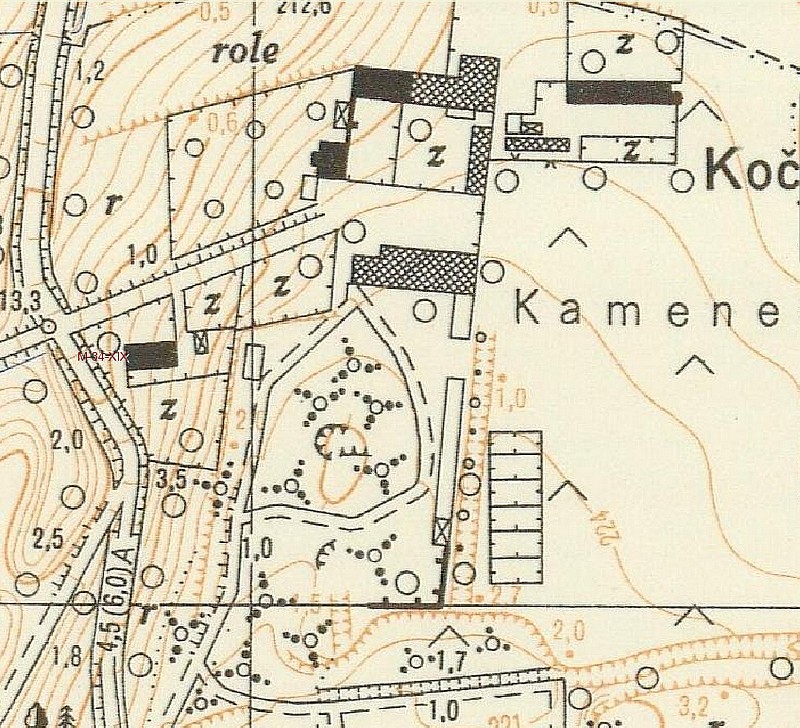
There are a few photos from that time and only one hand-made sketch that Karl Jawurek prepared from memory after the expulsion of 1945 in scale 1:500: Around 1933, Karl Jawurek (* May 30, 1885 in Heraletz / Moravian Herálec, † 27 October 1976 in Bad Reichenhall), who in previous years had already served as estate manager ("Obergutsverwalter") for the whole estate of the noble family Larisch-Mönnich, took over this brickyard as well as an integrated agricultural and livestock farming operation and renamed it "Jawurek & Co. steam brick and fireclay goods factory".
This brickyard was located on a hill called Kočendovec almost 2 kilometers east from the city center of Oderberg (today: Bohumín) in the district Zablacz (now: Záblatí) in today's road Rychvaldská 50, 73552 Bohumín, Czech Republic (49°53'51.9"N 18° 22'55.6"E). Other street numbers of the still existing buildings of the factory are 221 and 183.
There are a few photos from that time and only one hand-made sketch that Karl Jawurek prepared from memory after the expulsion of 1945 in scale 1:500:
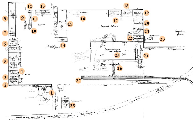  The site of the brickyard (without the associated large adjoining fields and forests) comprised a total area of nearly 50,000m2 and consisted mainly of the following areas and individual buildings (clockwise):

Quellen:
http://regiony.kurzy.cz/~nr/kn/ku/789216/mapa/ (PDF)
http://www.archives.cz/zao/opava/ (PDF)
http://badatelna.eu/fond/22256/ (PDF)
https://www.mesto-bohumin.cz/en/tiskove-konference/town-bohumin/pudlov-english/ (PDF)
http://www.kronikazelstanicebohumin.estranky.cz/clanky/bohuminske-vlecky/vlecka-cihlena-zablati.html (PDF)
http://de.wikipedia.org/wiki/Fanny_Starhemberg (PDF)
http://www.onb.ac.at/ariadne/vfb/bio_starhemberg.htm (PDF)
http://oldmaps.geolab.cz/map_viewer.pl?z_height=800&lang=de&z_width=1024&map_root=2vm&map_region=mo&map_list=O_4_X (PDF)
The Railway Connection
The brickyard owned a private 2,256 m long railway connection with the track gauge 1435mm ("Standard gauge") through the forest Baginec with steep gradients (27 m elevation between Brickworks and Railway Station) passing through the street Lidická directly to the train station in Oderberg (now: Železniční stanice Bohumín) and at the factory site there was a loading ramp and a 95 m long and 17 m wide loading bay, in which the bricks loaded directly from the brick storehouse on wagons and then via Oderberg on to the Košice–Bohumín Railway. During the heyday of the Brickyard around 400 wagons drove over this route. The Košice–Bohumín Railway was mainly used for cargo and joined the Hungarian with the German rail network, among others goods it transported Agricultural goods, bricks, coal, ores and timber.
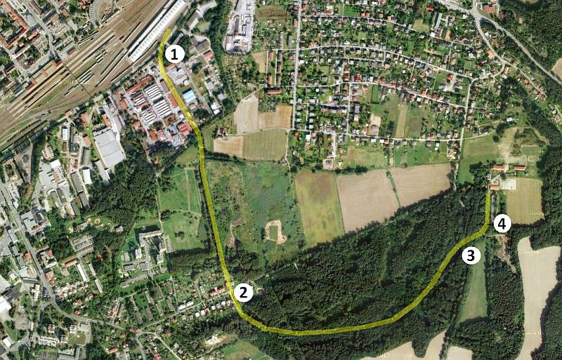 In 1949, shortly after the nationalization a year earlier, this railway connection between station and brickyard (Železnice Bohumín nádrazí - Baginec cihelna) was found "unsuitable" and degraded little later. Today only isolated remnants remain of this track:
With the elimination of the rail connection without replacement the brickyard was taken their most important transport connection.
Quellen:
http://www.kronikazelstanicebohumin.estranky.cz/clanky/bohuminske-vlecky/vlecka-cihlena-zablati.html (PDF)
http://zrus-zan-zel.blog.cz/0804/zeleznice-bohumin-baginec-cihelna (PDF)
http://www.oberegger2.org/enzyklopaedie/kaod.htm (PDF)
The Nationalization 1948
The basis for the nationalization was the Plan for the expulsion of the ethnic German population from rebuilt Czechoslovakia, developed during 1940 to 1945 by the Czech government in exile headed by Edvard Beneš. Because of these "Decrees of the President of the Republic" ("Dekrety presidenta Republiky"), after the war and fueled by Nazi terror during the German occupation more than 3 million Sudeten Germans were denied citizenship and civil rights, their assets were confiscated and they were forced to move. Thousands of industries and millions of hectares of agricultural land were nationalized. Georg Adam Graf von Starhemberg emigrated to Austria in 1945. The vast majority of refugees, about one million, settled in Bavaria, so did Karl Jawurek, who - after the then (czech) mayor of Oderberg gave him a telephone warning about an imminent attack of an anti-German mob - left his home in Záblatí with his family within a few hours around February 1945 initially to Wachsenberg and Attnang in Austria until he arrived in Bad Reichenhall in Bavaria.
Quellen:
http://de.wikipedia.org/wiki/Bene%C5%A1-Dekrete (PDF)
http://www.epravo.cz/vyhledavani-aspi/?Id=18450&Section=1&IdPara=1&ParaC=2 (PDF)
Current State
Little is known about the use of the buildings during the time after the nationalization between 1948 to 2005. But it is certain that large parts of the brickyard (the actual brick plant including kiln house and drying hall, the chimneys, the carbon stock and machinery spaces and multiple production facilities) as well as the railway line were already removed in 1952, only 4 years after nationalization, as shown on a map from 1952:
 The remaining barns, residential and storage buildings as well as the manor were largely left to decay. Starting in 1962, a state pig farm was located on the grounds, then later until 2005, a car junkyard.
In 2005, the former state-owned company was privatized and today the Riding Club Bohumín Kočendovec ("Jezdecký club Bohumín Kočendovec") is operating on the former factory site and slowly life starts again with the restoration of the still remaining and the construction of new buildings:
Quellen:
http://www.mapy.cz/zakladni?x=18.3797460&y=49.8970484&z=16&q=bohumin (PDF)
http://historickemapy.cuzk.cz/ (PDF)
http://jk-kocendovec.cz/ (PDF)
http://hlbedroom.rajce.idnes.cz/ (PDF)
Comments
This website was created properly to the best of my knowledge and belief, complete and current with the utmost dilligence from publicly available sources only. Wherever I have collected information from external sources, I have listed the corresponding references. It is my greatest desire not to violate any third party rights (including copyright and trademark rights, personal rights or other rights) and all photos shown are, to my knowledge, free of third party rights or clearly marked. If you have legitimate objections to the publication of a text or an image on this website, please contact me at mail@jawurek.kohsiek.de so that I can remove the object.

|
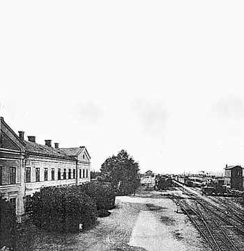 Train station Oderberg around 1915
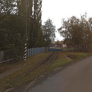 1.) Connection at the street "Lidická"© GIS-STAVINVEX a.s.
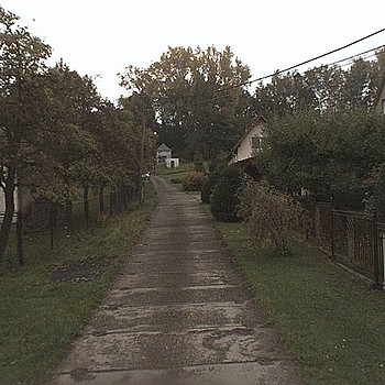 2.) Former rails at the street "Budovatelská"© GIS-STAVINVEX a.s.
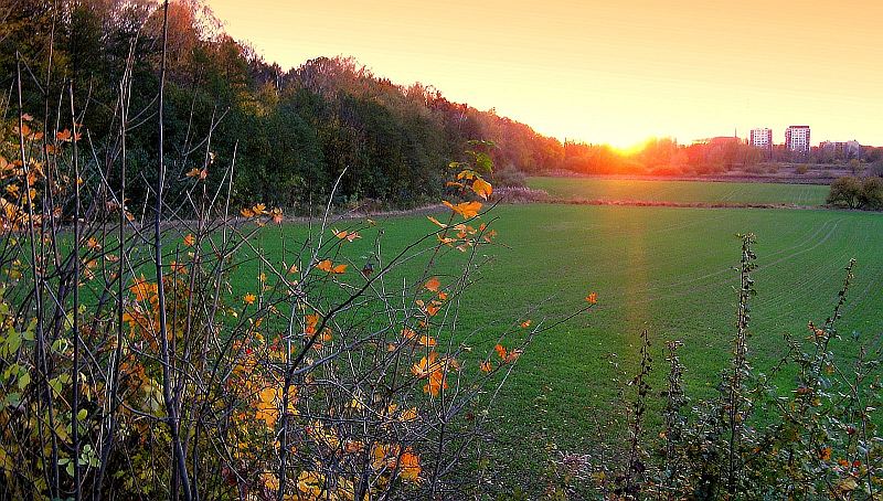
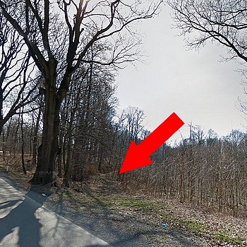 3.) Former rails in the Baginec forest© GIS-STAVINVEX a.s.
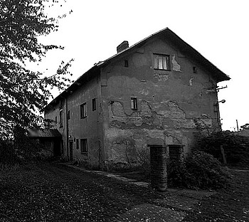 The manor in 2009© GIS-STAVINVEX a.s.
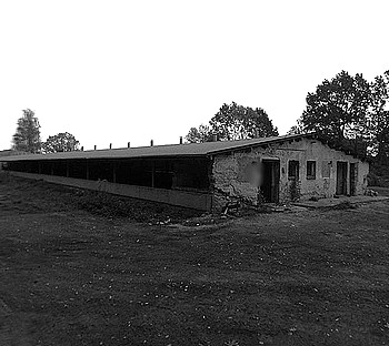 The loading hall 2009© GIS-STAVINVEX a.s.
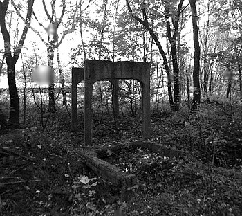 Remains of the traverser 2009© GIS-STAVINVEX a.s.
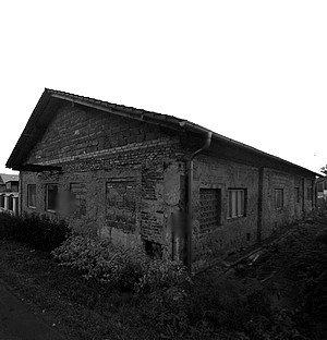 House built from the ruins of old buildings© GIS-STAVINVEX a.s.
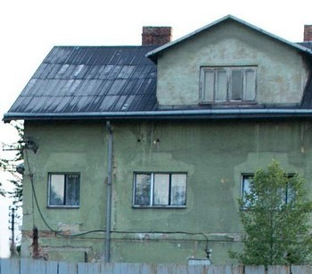 The manor (2013)© Ing. Petr Mrhač
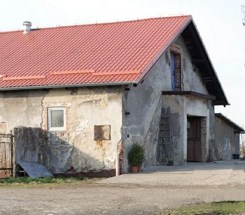 Partial view of house no.221 (2014)© Ing. Petr Mrhač
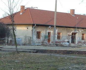 Partial view of house no.183 (2014)© Ing. Petr Mrhač
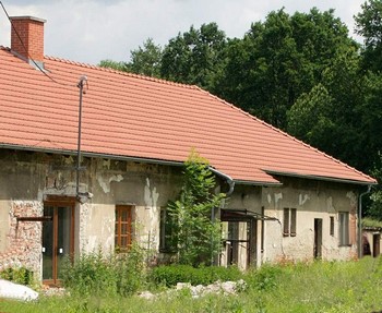 Partial view of house no.183 (2014)© Ing. Petr Mrhač